The overstory view, why it matters
The name Overstory comes from forestry: the overstory is the top canopy layer, the perspective that lets you see how everything connects. That's the idea behind drone land surveys, you get the picture that no ground walk can give you.
Connecticut has some of the most varied and interesting landscape in New England, from the Litchfield Hills to the Connecticut River Valley to the southeastern shoreline. Landowners, conservation organizations, timber managers, and land trusts all have legitimate reasons to document their land from above.
I can cover hundreds of acres in a single flight and deliver organized aerial documentation within 48 hours. For larger or more complex projects, I'll put together a custom quote.
What CT landowners use aerial surveys for
Boundary Documentation
Aerial documentation of property boundaries for large parcels, useful when surveying stakes are in place and a visual record of the boundary line and surrounding land features is needed.
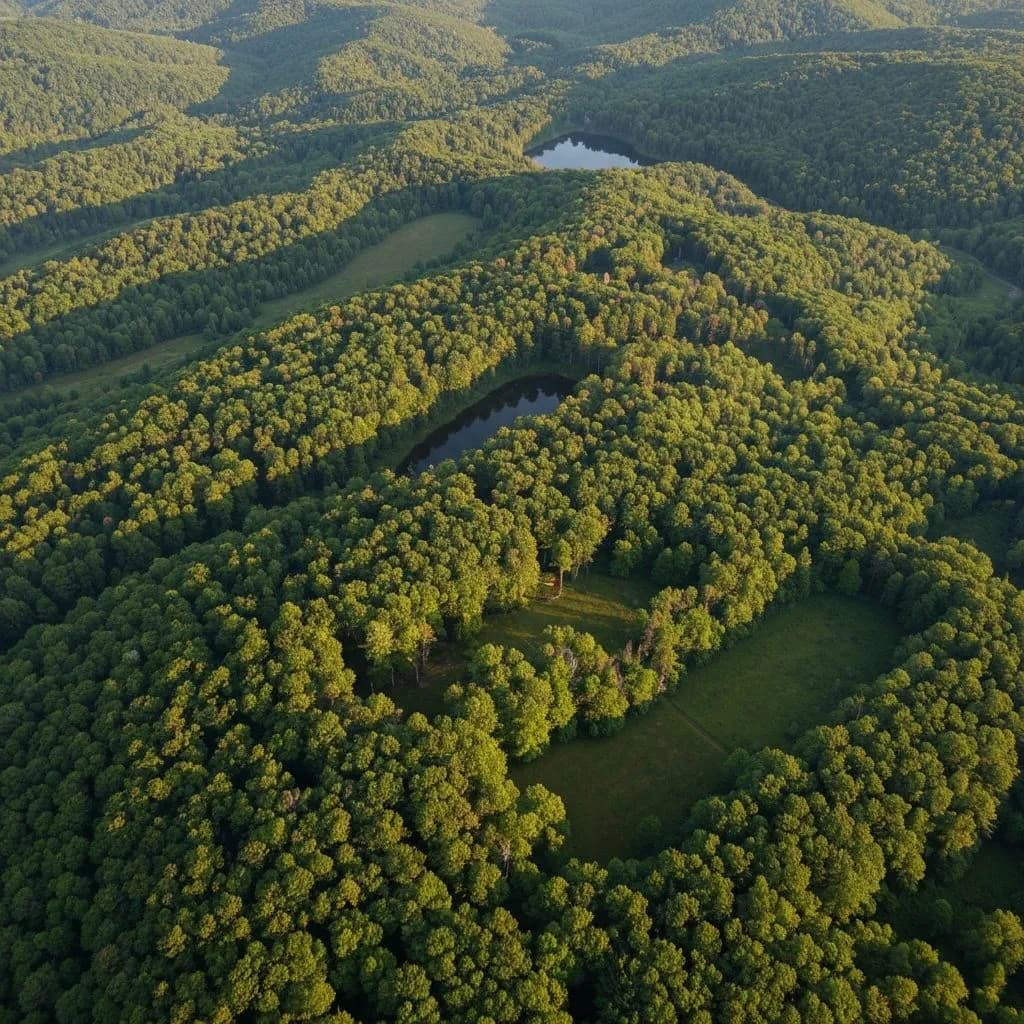
Timber Inventory
Aerial canopy assessment for woodlot owners and timber companies evaluating a parcel. Drone imagery provides species distribution estimates, canopy density, and overall stand health from above.
Wetland Monitoring
Seasonal aerial documentation of wetland boundaries, water extent, and buffer zone conditions. Useful for conservation organizations, land trusts, and municipalities.
Conservation Land Documentation
Aerial documentation for land trusts and conservation organizations monitoring protected parcels. Builds a visual baseline for detecting encroachment, erosion, or habitat change over time.
Estate & Parcel Assessment
Aerial overview of large residential or agricultural parcels for estate planning, sale preparation, or owner documentation. Particularly valuable in Litchfield County and inland Connecticut.
Orchard & Agricultural Land
Aerial documentation of agricultural operations, orchard layout, field conditions, drainage patterns, and crop health assessment from above.
What's included in a land survey flight
- Full parcel aerial coverage, every part of the property documented
- High-resolution still images organized by section or grid
- Aerial video flythrough of the full parcel
- Orthomosaic map output available on request (priced separately)
- All FAA airspace authorizations handled
- Deliverables within 48 hours for standard parcels
- Multi-visit monitoring schedule available at discounted rate
A basic aerial documentation flight starts at $49. From there, pricing scales with parcel size and the deliverables you need: organized imagery, video, repeat baseline visits, or orthomosaic maps. Send me the parcel address and acreage and I'll get you a same-day estimate.
Annual monitoring and before and after documentation
The most useful thing a land trust can put on a protected parcel is a clean, dated aerial record taken every year from the same vantage points. That is the baseline that flags encroachment, storm damage, stream changes, and stewardship work over time.
Annual baseline monitoring
Repeatable flight plans flown the same time of year, organized by parcel. Useful for board reporting, stewardship records, and grant requirements.
Before and after documentation
Storm aftermath, invasive species clearing, trail work, dam removal, meadow restoration. A short aerial visit before and after captures the change in a single, clean record.
I work with land trusts across Fairfield County and beyond, including groups like Aspetuck Land Trust, Greenwich Land Trust, New Canaan Land Trust, and Norwalk River Valley Trail partners. Reach out about a baseline visit on one parcel or a multi parcel annual schedule.
Serving Litchfield County & All of Connecticut
I cover the full state, from Fairfield County estates to Litchfield Hills farms to the Connecticut River Valley. Large-parcel drone surveys are especially common in western Connecticut where properties run 10-100+ acres.